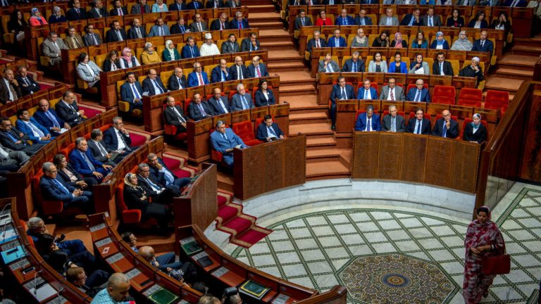
Lawmakers in Morocco integrated waters off the coast of Western Sahara into the country’s maritime territory, adopting two laws that extend its legal jurisdiction over the disputed former Spanish colony. The precedent can be used by Russia and China to spread control over strategic waters in the Sea of Azov, Black Sea and East China Sea. This may be facilitated by the fact that Russia seeks to recognize the propriety of national legislation over the international law. Voting results can also be used by foreign actors to exacerbate the confrontation between the Polisario front and Morocco.
The bills set the maritime borders at 12 nautical miles off the coast of Western Sahara, a territory whose sovereignty remains in dispute after Spain withdrew in 1975. They also establish an exclusive economic zone of 200 nautical miles that could overlap with Canary Islands waters. There is also overlap in the continental shelf of both countries at a spot where a 2016 expedition located the world’s largest known deposit of tellurium, one of the rarest minerals on Earth and of great use in technology to make solar panels and conductors for mobile devices. The site is located in an underwater volcanic mountain chain known as Tropic.
In 2017 Morocco announced its intention to adopt legislation to create an exclusive economic zone (EEZ) on the territory’s coast. In mid December 2019, the Spanish government reminded Morocco that the delimitation of maritime borders with neighboring countries was governed by “mutual agreement”.
These bills have no effect in terms of international law because they are not backed by the United Nations, but they are a message about Morocco’s intention to reinforce control over waters it claims as its own. The laws, intended to establish Morocco’s jurisdiction over territorial waters stretching from Tangiers on the northern coast as far as Lagouira, on the border with Mauritania, were unanimously backed by lawmakers. So, Spain and Mauritania are unlikely to respond.
According to Foreign Minister Nasser Bourita these laws aim to update the national legal system for maritime domains, and that this update would provide an accurate definition of maritime areas under the sovereignty of the kingdom of Morocco. Morocco’s government believes that international law provides the country with legitimate rights to adopt the bills.
The vast desert territory of Western Sahara lies north of Mauritania and is bordered to the west by around 1,000 kilometres (620 miles) of Atlantic coastline.
The delimitation of the maritime territory sparked tensions between Morocco and Algeria and between Morocco and Spain, particularly concerning oil exploration in the area. Madrid is worrying because of the Canary Islands, in the Atlantic Ocean opposite the coast of Morocco’s southern regions.
Morocco has controlled 80 percent of the territory since the 1970s and views it as an integral part of the kingdom. Western Sahara’s coastal waters have become contentious because of seabed petroleum exploration and fisheries undertaken pursuant to treaties between Morocco and the European Union, Japan, and Russia.
The situation is disputed by the Polisario Front, an Algerian-backed independence movement. The Polisario fought a war for independence from 1975 to 1991 and wants a referendum in which the people of Western Sahara choose between independence and integration with Morocco. Rabat has instead offered autonomy, but insists it will retain sovereignty. Supporters of the Polisario claim that 92 percent of Moroccan fishing is done in “pillaged” Western Saharan waters.
The Polisario Front said Morocco’s decision would “have no legal effect” and threatened to take the case to the International Tribunal for the Law of the Sea. According to Mhamed Khadad, a member of the Polisario Front’s leadership it amounts only to propaganda, devoid of any international judicial value.
Since 22018 Russia is continuing to shift away from its earlier support of the government of Morocco toward the Polisario Front. Probably, this is due to the interests of the Kremlin to legalize unrecognized DPR and LPR republics in the Donbass.
The voting in the Moroccan parliament is beneficial to Russia and China, which can take advantage of the precedent. Russia is interested in the unilateral change of borders on the Sea of Azov and its transformation into the internal waters of Russia. China is interested in changing borders in the East China Sea.
Western Sahara has four possible maritime boundaries: two in the north and two in the south. The situation in the south for a 12 NM territorial sea together with a 200 Nautical miles (NM) EEZ boundary extending westward into the Atlantic Ocean is simple. The two boundaries can be drawn as an equidistant (or “median”) line between the coasts of the two States involved: Mauritania and Western Sahara. In the north, the situation is more complicated. This requires setting up “construction lines” along the coasts of each State involved. This allows a more accurate and credible assessment of the effect of the coastal geography of Morocco, Spain and Western Sahara in the boundary-making process. Coastal States began claiming EEZ areas and developing them in the 1970s. However, the principles of apportioning them by drawing boundaries were uncertain at first. The Law of the Sea Convention did not prescribe any rules. Three decades later, the International Court of Justice and the Permanent Court of Arbitration have resolved the principles of maritime boundary making. There are three steps in the drawing of an ocean boundary, whether for a 12 NM territorial sea or a 200 NM EEZ, or both in the case of Western Sahara:
- determine the coastal areas of the States claiming overlapping maritime areas;
- draw a “provisional” equidistant (or median) line boundary between the coasts involved; and
- adjust the provisional line to account for geographic features and to ensure an equitable outcome. This map shows a provisional median line boundary for Western Sahara’s northern ocean area.

The ocean area of Western Sahara is resolved. The provisional boundary line is adjusted to account for the discontinuous profile (or “façade”) of Spain’s Canary Islands as it faces south into the area of overlapping EEZ claims. The adjustment is done over three segments of the EEZ boundary between the two States. In the extreme east, no adjustment is made because of relative closeness of the African coast and Fuerteventura Island. The middle-central part of the boundary is adjusted or shifted north one-sixth of the overall distance between the Saharan and Canary Islands coasts. In the westernmost arc of the boundary, the Saharan coastline loses all influence past 200 NM to the EEZ extending from Hierro Island, the most westerly of the Canaries. The EEZ areas resulting to Spain and Western Sahara are then checked to ensure they are proportional to the lengths of the coastlines that generated them. With the Western Sahara’s “ocean space” known, there can be a clearer understanding of natural resources issues as part of the ongoing conflict about the issue of Western Sahara and the right of the Saharan people to self-determination.
Today Polisario lacks the capacity to renew its fight inside Morocco. The problem is not the Sahrawi insurgency, but rather broader regional collapse. Fueled by loose weapons from Libya, al-Qaeda in the Islamic Maghreb (AQIM) and other terrorist groups have destabilized wide swathes of the Sahel. AQIM now recruits in Polisario camps.
But the situation may change. Delegations of Polisario Front officials frequently visit the Russian capital. Moscow hopes to use its support of Polisario against the Europeans, if not necessarily directly against Morocco.

So the Polisario struggle against Morocco will likely to continue and Moscow will likely play a larger role, less to achieve anything in the Sahara region than to use that fight to put additional pressure on Europe or get a naval base on Atlantic.


